Snow Peak Scramble via Burstall Pass
Hike
The trail to Burstall Pass is Bear
country so take precautions, I recommend hiking in a group versus doing this
one solo

Parking lot with washroom
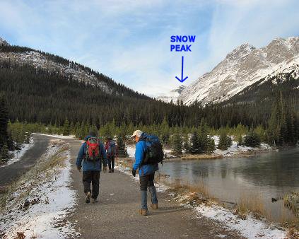
Start of hike to Burstall Pass with
Snow Peak way in the distance

Make sure you don't go wrong here as
we almost did
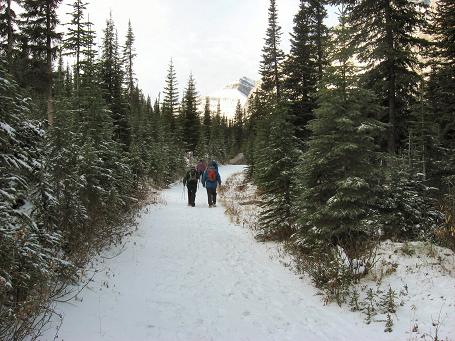
Good biking road for the first 3 km

Chains to lock your bikes to
After just under an hour the braided
stream meadows

The entrance into the trees from the
meadows

After ascending through the first set
of trees a flat area for a bit

Trail up to Burstall Pass

Near Burstall Pass the majestic Mt
Assiniboine comes into view!
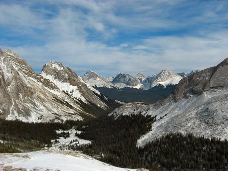
Looking back down the valley, Fortress
and Mt Chester in the far distance

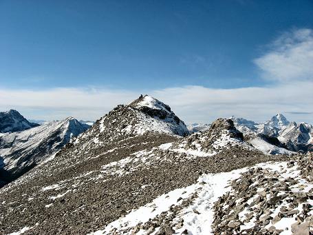
Heading towards Snow Peak from
Burstall Pass
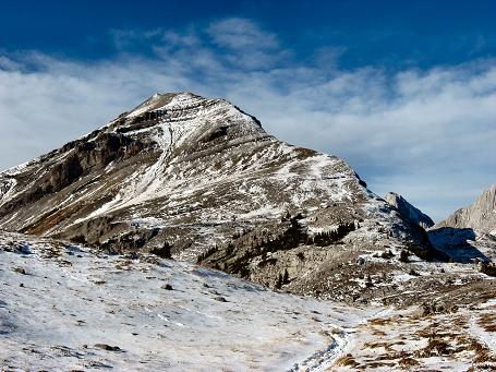
We ascended the right hand ridge line

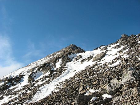
A closer view of the ascent line

Look back at Burstall Pass area

Fairly steep here

Very steep middle section but still
not hands down

View of slope angle and Sharks Fin in
the distance

Slope after the steepest section
Closer to rock bands

Closer view
Take this one straight on but be
careful to your right

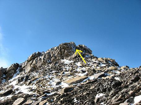
Last rock band before summit ridge
skirted to the left
Summit ridge, can't beat these views!

Mt Assiniboine

Yours truly, -2c, hardly any wind,
very nice!
Summit views

Leman Lake and the Sharks Fin

Mount Sir Douglas

Back on our way down from Burstall
Pass

More trail down from Burstall Pass

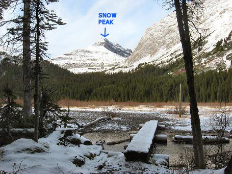
Goodbye Snow Peak
Back at the trail head, the end of a
beautiful day!
Snow Peak Scramble via Burstall Pass Hike
Scramble: Class 2 – Steep Hiking
Altitude: 2,789m (9,148 ft)
Elevation Gain: 900m (2,952 ft)
Ascent Time: 3 – 4 Hours, approx 19km round trip
Best Season to Scramble: August to September to avoid the
big water flows in the braided creek area of the meadows, may need sandals
to cross some streams, maybe not
The trail to Burstall Pass is Bear
country so take precautions, I recommend hiking in a group versus doing this
one solo
Highlights
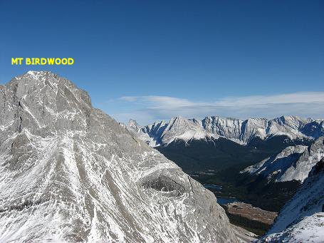
This scramble follows the hike to Burstall Pass,
outstanding scenery is everywhere from Mt Assiniboine, Mount Sir Douglas, Mt
Birdwood and Leman Lake
Getting There
Head west out of Calgary on the TransCanada highway # 1
for 79km (49.4 miles) and take the Kananaskis Country highway # 40 turnoff
and head south. Continue south and turn right into Peter Lougheed Provincial
Park which is 49km (30.6 miles) south of the TransCanada. From this turnoff
drive 2 km (1.25 miles) and turn right on Spray Lakes road driving around
another 20km (12.5 miles) north until you reach the Burstall Pass parking
lot on your left. Burstall Pass parking lot is big and well signed. If you
are coming from Banff you have to go through Canmore, up past the Nordic
Centre which turns into Spray Lakes road and head south for around 40km give
or take a few kms. The Burstall Pass parking lot is right across from the
Chester Lake parking lot if that helps you.
Route Description
From the Burstall Pass parking lot start off on the wide
trail making sure in a minute or two to head right on the proper trail
instead of the gravel road heading left (see photo). Many people bike this
part of the Burstall Pass trail for approx 3km to the bike lockup spot to
save some time. If you are hiking it’s about 3.5km or just under an hour to
the wooden bridge that takes you to the stream braided meadow area. Follow
the signs across the meadow to the entrance into the trees. From here it is
a steep section, then a flat section, then another steep section up to
Burstall Pass. Allow 2 to 2 ˝ hours to the pass including a snack break
along the way. Better to have a snack break before you get up onto the pass
proper as there may be considerable wind up there. From Burstall Pass the
way is obvious as Snow Peak dominates to the right. Allow 1 hour to 1 ˝
hours to the summit of Snow Peak.