Mt Sherman

Mt Sherman from our camping spot in the
basin at 11,700 feet
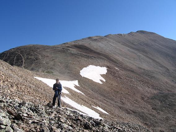
Near the saddle between Mt. Sheridan
and Sherman with the long ridge of Sherman behind me
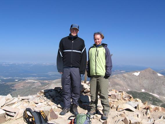
The summit of Sherman with Leadville
in the valley below

Victoria on the ridge of Sherman with
Mt. Sheridan behind
Mt. Sherman
Scramble: Class 2 – Steep Hiking
Altitude: 14,036 ft
Elevation Gain: 2,340 ft approx from camping spot at
11,700ft, 6.0 miles return
2,800 ft from old Leavick townsite at 11,240ft, 8.0 miles
return
Start Time: 5am to 8am to be on your way down by noon and
avoid potential lightning storms
Ascent Time: 2 – 3 Hours
Highlights
This scramble sits in a very attractive alpine basin, Mt.
Sheridan (13,748 ft) on the left and Mt. Sherman on the right. Victoria and
I enjoyed sitting at our campfire at 11,700ft, eating chips and salsa, and
taking in the view.
Getting There
Fourmile Creek Trailhead – 11,240 ft - No restrooms
From Fairplay, drive just over a mile south on U.S. 285
and turn right onto County Road 18. Drive 10+ miles to a large parking area
at 11,240ft. This is the Leavick site. There is a large mine building on the
right before the parking area. The road starts to get rough after this point
but passenger cars (proceed at your own risk) can slowly drive another 1.5
miles before the road gets harsh. Better if you have a high clearance
vehicle. There are a couple of small pull-offs between 11,700' and 11,900'
and more parking before a gate at 12,100'. The gate is usually closed.
Updated trailhead info available here
https://www.14ers.com/php14ers/trailheadsmain.php
Camping
At the Leavick parking area 11,240 ft and especially the
large pulloff at 11,700 ft you could set up the tent or sleep in your
vehicle. There is the forestry serviced Fourmile Creek Campground with
restrooms ($11) a couple of miles prior to the Leavick parking area or
approx 8.0 miles from highway 285.
Route Description