Little Hector Scramble
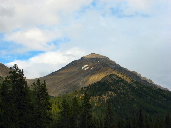
Photo from the parking lot. The upper
summit slope is very foreshortened! Be prepared to persevere!

Left up the right side of the creek
bed

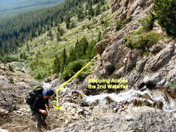
Approaching the first and second
waterfall
Just before the first waterfall the
trail crosses the creek and goes up the left hand side to access the second
waterfall area

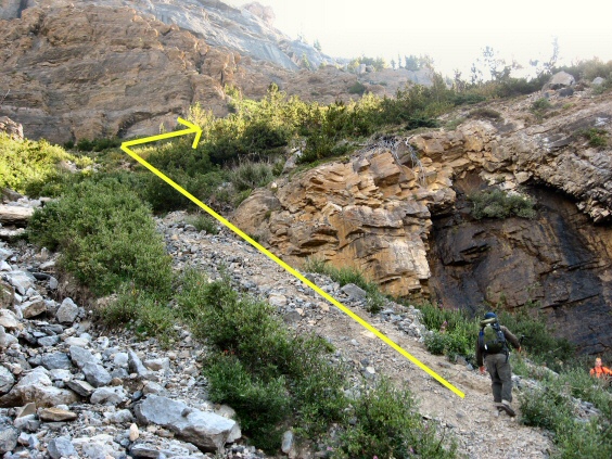
The route to cross over the second
waterfall by a overgrown trail along the rock wall. Some are using the harder
option of going directly up the rock.
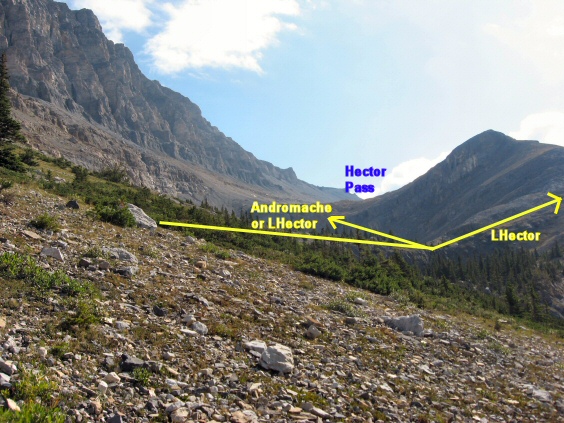
Unfortunately our group ascended to
Hector pass which is slightly longer than the quicker route labeled "LHector".
Oh well, trail is better to Hector Pass but maybe extra 10 minutes.

Another closer view the the two
routes

Closer view of trail up to Hector
Pass. Andromache is accessed from the Pass also
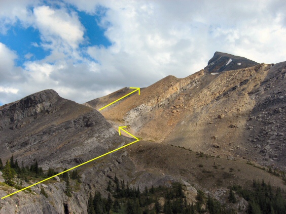
Slightly faster route but more off
trail. One may also be able to climb along the beige and grey band to access
the lower slope of Little Hector

Once near Hector Pass you can head
directly right to the lower slope of Little Hector on fairly solid and slabby
terrain.
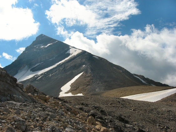
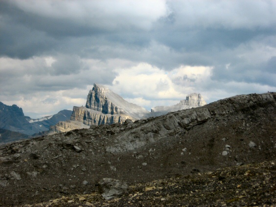
A nice view of our objective!
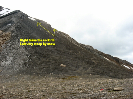
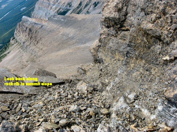
A bit of hands down along the rock
rib or near the top left part of the snow. Quite steep indeed!
Views are opening up and an idea of
the slope angle
Molar Mountain comes into view to the
east
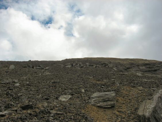
The long foreshortened summit slope
at last!
And more of it

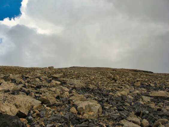
Summit is just past the black area at
the top

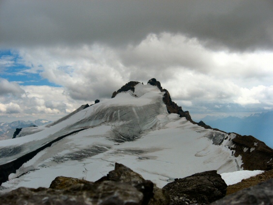
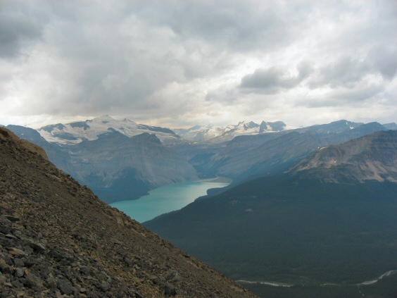
Big Hector! That glacier has taken a
few lives!
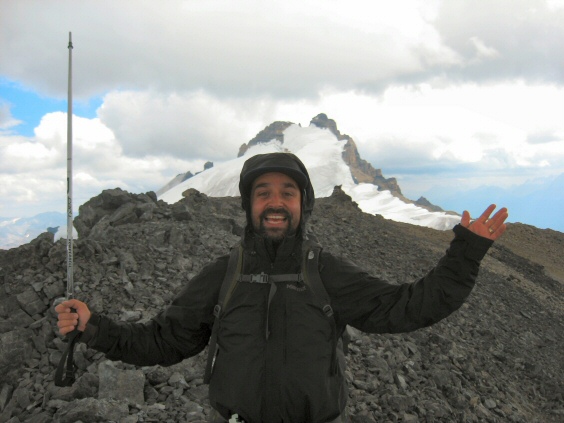
Adeem arrives on the summit


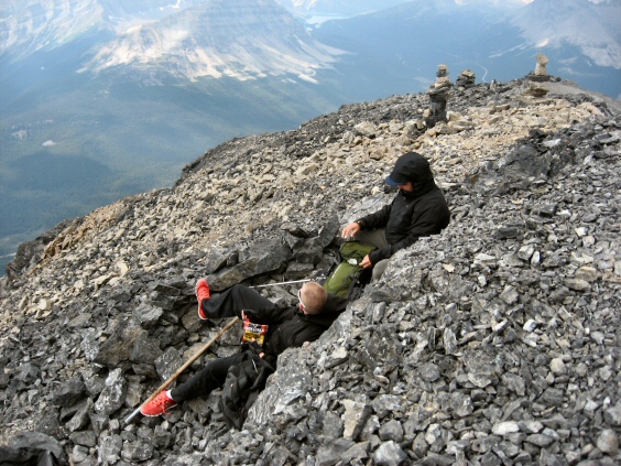
Relaxing after the big effort!
Little Hector Scramble
Scramble: Class 1 and 2 – Steep Hiking, Some Use of Hands, Care on
Upper Waterfall Ledges Required
Altitude: 3,125m (10,250 ft)
Elevation Gain: 1,260m (4,133 ft)
Ascent Time: 3 1/2 – 4 1/2 Hours
Best Season to Scramble: July to September
Highlights
This scramble offers a great view of glacier clad Mount Hector
to the south and to the West and North, Hector Lake, Bow Lake and the Icefields in
between. Views up Andromache and Unnamed Peak from Hector
Pass are also in plain view.
Getting There
Head west out of Calgary on the TransCanada highway # 1, just a
few kms past Lake Louise (187km/116.9mi) take the Icefields Parkway north for around 20km.
If your base is Banff head west on the TransCanada to Lake Louise 56km (35.0 miles) and
just past Lake Louise take the Icefields Parkway north for around 20km. The parking spot
is opposite the valley between Andromache and Mount Hector and is on the left side (West)
of the highway. A small cairn and footpath on the road hillside (East side of highway)
should be there.
Route Description
Take this footpath and shortly you come to a creek bed with a
broader trail heading off to the right. Don’t head right, but go left up the creek
bed on the creek bed’s right hand side. Get it! Lol! The trail along the creek bed
crosses over to the left side just below cliff bands with lower and upper waterfalls. You
get through into the upper valley by climbing up the left side of the waterfall and along
ledges actually stepping across the upper waterfall to the right side. Be careful if
it’s still icy here. Allow around 40 minutes to the upper waterfall.
From here you enter the basin that
leads to Hector Pass or an early detour to the right for Little Hector. Either
route will allow you to access the lower black slope of Little Hector. The
photos above give you the best view as to accessing the black slope of Little
Hector which puts you on the very foreshortened summit slope.
