Mt Cornwall - Bragg Creek Elbow Falls Area

South Glasgow Creek drainage goes up
the narrow valley between the two ridges

A view of the col and summit of Mt
Cornwall, Mt Glasgow's south ridge is to the right of the col

Slabby waterfall area 5 min past where we
headed right up and out of the creek drainage to climb the slopes of Glasgow
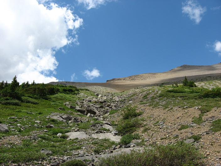
Slopes directly below the col which we
took on the way back to the creek

Route up Mt Cornwall from the col

A wider view of the area taken
from Mt Cornwall, we came up the long creek drainage in the lower right

The ridge walk over to the summit of Mt
Cornwall

A view from the summit of Mt Cornwall
Mt Cornwall
Scramble: Class 1
Altitude: 2,978 m (9,770 ft)
Ascent Time: 1 hour from col after climbing Mt Glasgow –
see Glasgow write-up
Elevation Gain: from col 370 m (1,214 ft)
Best Season to Scramble: July to September – would
recommend early August to avoid mosquito’s and creek would still be running
to pump water from
Highlights
Along with Glasgow there are 3 other peaks all in the
same area Cornwall, Banded Peak and Outlaw but the approaches are really
long and make for a very draining day to summit any of these. Most people
bike a portion of the Big Elbow or Little Elbow trails to reach these, not
appealing to me either since I can't bike due to injury. Therefore I looked at Plan B,
hike up South Glasgow Creek and
bivy the night before, then bag both Glasgow and Cornwall from our
high bivy the next day then hike out. So we hiked up the creek the night
before for 3+ hours and bivied next to the creek, climbed both peaks
and hiked out the next day. The plan actually worked very well and two
summits were obtained. I recommend climbing Glasgow first then come back to
the col between Glasgow and Cornwall and its only 1 hour up to bag Cornwall
on a scree trail.
Getting There
Head out to Bragg Creek and onto highway 66 to Elbow
Falls. Drive right into the Little Elbow campground and find a small parking
lot only 30 feet away from the suspension bridge which you need to cross to
get on the Big Elbow trail.
Route Description
Cross the suspension bridge and head left for a bit, then
right and up to an intersection which has a green trail direction sign.
Follow on south and you should hit another sign saying you are entering the
Big Elbow trail "Are you prepared" lol! This section of the Big Elbow trail
is about a 3 km walk with 2 small hills and takes about 40 minutes. From
here you will see about 30 yards to your right a wide creek bed. This is
South Glasgow Creek. Take a sharp right onto this creek bed and head back
kind of Northwest for a bit. The creek bed eventually curves around back
heading Southwest, then enters a narrow valley or drainage heading west up
to the Cornwall headwall.
There are 2 places in the drainage that you need to move
left, then right above the creek bed to bypass small canyon areas. The first
one you head up the left bank to bypass the first canyon spot then as you
come down to the creek above the first small canyon area you immediately
cross the creek and you head up into the forest on the right side (cairn
here) to bypass a longer canyon stretch. This longer stretch through the
trees is more difficult as the trail is faint but the thing is to keep next
to edge of the trees closest to the high creek bank and when you get above
the second canyon area find a spot to descend back to the creek bed.
It would be nice if some trail work was done on the
longer second canyon area in order to improve route finding.
Once above the two canyon areas its straightforward
working your way as far up the creek as you would like to go before setting
up camp. Our bivy took around 3 ˝ hours to get to. It was only about 5
minutes away from the spot we picked to go up the long gray slopes to climb
Glasgow and about 10 minutes away from the slabby waterfall area which gives
more direct access to the col between Cornwall and Glasgow. I recommend our
route as we did Glasgow first, came back to the col, then 1 hour up to climb
Cornwall, then descended the sandy brown slope below the col to the slabby
waterfall area then back down the creek. The peak climbing day including summit
time was around 11 hours back to the car. Started at
6:30 am back to the car 6pm. Voila two summits!